2001.1.34
27-Feb-53
7.75 in HIGH x 10 in WIDE
(19.68 cm HIGH x 25.40 cm WIDE)
(19.68 cm HIGH x 25.40 cm WIDE)
The Oakland Tribune Collection, the Oakland Museum of California. Gift of ANG Newspapers
2001.1.34
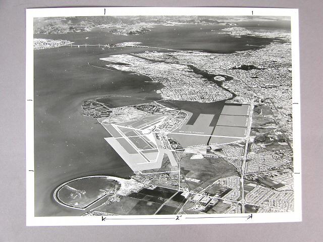
A wide angle view of San Francisco Bay showing the Bay Bridge,Oakland, the Estuary, Lake Merritt, Richmond, Alcatraz Island, and Marin County, taken from a point just south of the Oakland Airport. Two notations on the back read 1) "overall view of proposed expansion of the Oakland Municipal Airport under $10,000,000 general obligation bond issue on April 21." 2) "This plan has been abandoned Don't use" The tip of present day Bay Farm Island has not yet been filled in, and marsh land to the east of the Airport has been blocked in for expansion. Cultural names, such as Hegenberger Rd. and East Shore freeway have been added.
Used: Oakland Tribune

© 2024 Oakland Museum of California
RIGHTS AND REPRODUCTION