H69.219.1


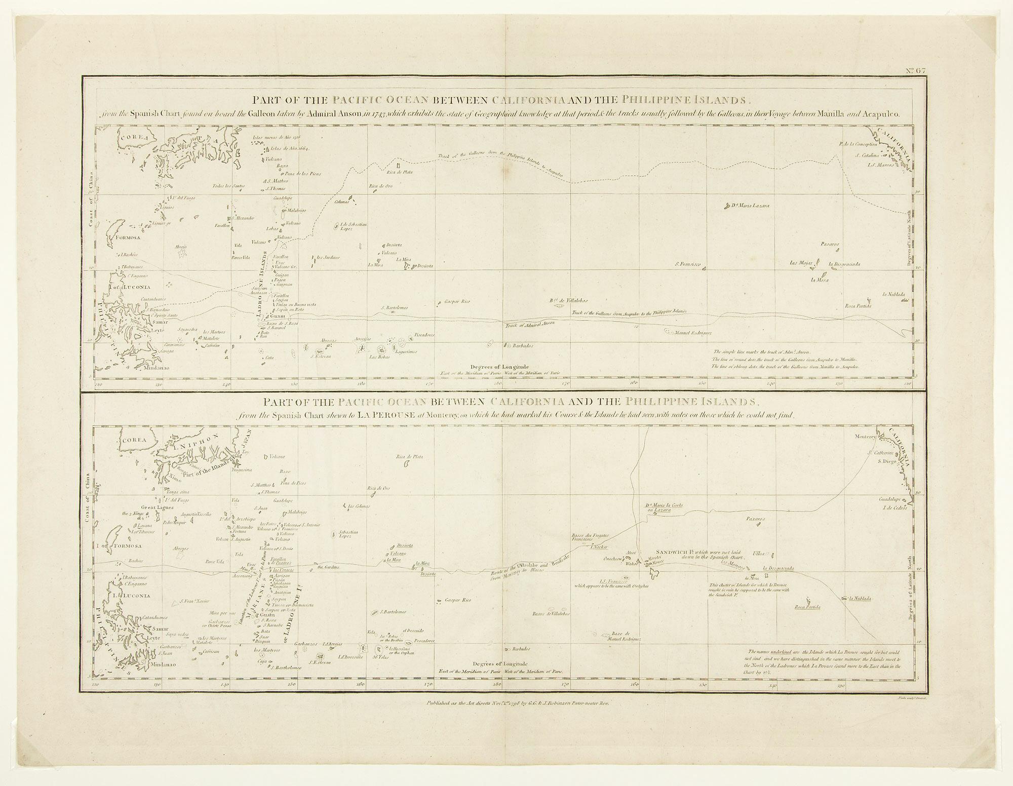
Map. Description: mounted; 2 maps --- "Part of the Pacific Ocean Between California and the Philippine Islands, from the Spanish Chart found on board the Galleon taken by Admiral Anson, in 1743, which exhibits the state of geographical knowledge at that period, and the tracks usually followed by the Galleons, in their Voyage between Manilla and Acapulco"; "Part of the Pacific Ocean Between California and the Philippine Islands, from the Spanish Chart shewn to La Perouse at Monterey, on which he had marked his Course and the Islands he had seen, with notes on those which he could not find."

© 2024 Oakland Museum of California
RIGHTS AND REPRODUCTION