H69.38.1632
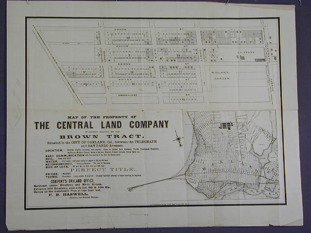
Map of the property of the Central Land Company...
1875-1900
Gift of Mr. William G. Boardman
H69.38.1632
The area shown in this subdivision map is bounded by Telegraph Ave. on the east and San Pablo Ave. on the west. Brockhurst St. is the southern boundary street and Logan (or 36th) is the boundary street at the north. Lots front on Telegraph Ave., Grove St., West St., Market St. Brockhurst S. Nolan St. (33rd), Brown St. (34th), Walton St. (35th), and Logan St. (36th) The "Tract List" compiled by Quentin dates the Central Land Company Tract at 1870. At that point in time, Logan St. was the most northerly street within the city limits of Oakland. An index map is also provided which shows the tract as a darkly shaded area. The context of this broadside is identical to the record h69.38.1631; the format is slightly different in that the index map on this document is not an inset and is slightly larger than the other.
Used: William F. Boardman

© 2024 Oakland Museum of California
RIGHTS AND REPRODUCTION