H69.38.1732
[Chinatown and Central District]
1875-1900
Gift of Mr. William G. Boardman
H69.38.1732
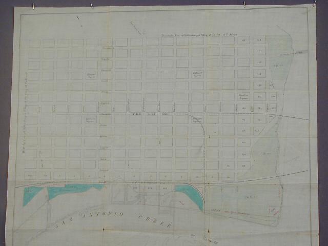
The area of this map is basically downtown Oakland, from West St. on the west to Fallon St. to the east; the northern boundary street is 14th St., and the southern boundary street is 1st St. The unsubdivided areas abutting on San Antonio Creek and the Estuary are shaded light and dark green. These appear to be park-like areas; acreage is provided for each area. Pencilled in on an arcing line in the middle of San Antonio Creek, is "North line of Oakland Harbor as proposed by Col. Mendell. Also pencilled in are areas (more or less city blocks on the shore) identified as: Merritt, C.P.R.R.. Co., and City Whf. This appears to be a standard printed map of the city, with additions in pencil.
Used: William F. Boardman

© 2024 Oakland Museum of California
RIGHTS AND REPRODUCTION