H74.380.1
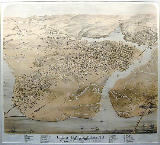
On this map, you can see the original line of the Transcontinental Railroad (Central Pacific, later to become Southern Pacific) coming into Oakland from the south, running up 7th Street out to the Long Wharf in West Oakland. The Transcontinental passenger station, which welcomed the first Transcontinental train in 1869, was on the northwest corner of 7th and Broadway.(On the Transcontinental Railroad it took about 6 days to go from the East Coast to California. That compares to 118 days by ship around the Horn of South America or 20 days by stage coach from St. Joseph, Missouri to Carson City, Nevada, as described by Mark Twain in Roughing It. ) You can also see a second rail line that was built along 1st Street early in the 1870s. It was mainly for cargo and through passengers while the line on 7th Street made local stops. It converges with the 7th St. line at the Long Wharf in West Oakland.(The first Oakland Pier at the Point in West Oakland, built about 1863, was extended by the Central Pacific to 6,900 feet in 1869. In Janury1871, The Long Wharf (about 2 miles long) opened parallel to the Pier. The Pier itself, a trestle, was filled in as an earth embankment, and extended; it opened as the Oakland Mole in January 1882. After that, the Long Wharf handled freight until 1918, while the Mole served Southern Pacific passengers.)From Beth Bagwell, "Oakland, Story of a City"
