Browse the Collection
|
1875-1900
The Kingsland Tract is bounded on the west by Central Ave. (east 56th St.) and on the east by Seminary Ave. The southern boundary street is east 14th St. and the northern boundary street is Trask... |
1875-1900
The Clinton Mound Tract is bound on the west by Walnut or Grand Ave, and on the east by Mountain View Ave. The northern boundary street is Almost St. (Bancroft Ave.) and the southern boundary is... |
|
1875-1900
In this original map, an area on both sides of University Ave. (now College Ave.) are shown. The area east of University Ave. is bounded on the south by Fourth Ave. (now Manila Ave.), on the... |
1875-1900
The area shown in this original map is bounded on the west by Webster St., on the north by 13th St., on the east by the Oakland Estuary, and on the south by the Inner Harbor and Estuary Park. The... |
|
1875-1900
This map of the waterfront areas of Oakland, Brooklyn, and Alameda, shows the southern boundary of the City of Oakland to be contiguous to the north west coast of Alameda; that boundary was... |
1875-1900
This collection of 4 maps of the Sather Estate Tract and its environs appears to show the evolution of plans for an Oakland city park. Each map is essentially identical with the exception of the... |
|
William F. Boardman
1875-1900
This map is basically the same as 2075 and shows the proposed pipeline from the reservoir near LaGrange to Oakland. This map shows the proposed line in yellow and then an inset is included with a... |
1875-1900
The areas shown on this blueprint map are Lake Merritt and the neighborhoods around its perimiter. The undeveloped area north of the lake is identified by the name Edson Adams. ... |
|
George L. Nusbaumer
1875-1900
The area shown on this map begins at about what is today 24th Ave. (Oakland city limits?) on the west and extends to the east to San Leandro Creek and Lake Chabot. The township is divided into... |
1875-1900|1872
In this original ink-drawn map, the western boundary street is Seminary Ave and the eastern boundary street is Gibson Ave. The subdivision is bounded on the south by First St. and on the north by... |
|
1875-1900|1875-1900
This subdivision is bounded on the west by Waldo St., on the north by Charles St., on the east by McAdam St., and on the south by Stafford St. Santa Rosa St. bisects the subdivision in an east-... |
Britton and Rey | San Francisco
1875-1900|ca. 1868
The lots shown on this subdivision map are bounded on the south partially by 41st, 42d, 43d, and 44th Sts.; the northern boundary of the subdivision is Temescal Creek. Telegraph Ave. is the... |
|
Bacon & Company
1876
The area shown on the subdivision map is bounded on the west by Dover St. and on the east by Shattuck St. The boundary street on the north is Benton St. (perhaps 61st St.) and on the south by Mono... |
Butler & Bowman
1876
Map, real estate advertisement. The lots shown for sale are on West 8th-11th Sts., bounded by Center and Kirkham Sts. T.J. Arnold is shown to have surveyed the property in August 1875. J.O.... |
|
Butler & Bowman
1876
The area shown on this map is bound on the east by Kirkham St. and on the west by Center St. The southern boundary is 8th St. and the northern boundary is 11th St. The area is bisected by... |
Butler & Bowman
1876
This brochure shows the location of several properties for sale at auction on Saturday, June 24, 1876, at 2 p.m. by Olney & Co., 857 Broadway, Oakland, and 219 Sansome St., San Francisco. The... |
|
William F. Boardman
1876
Original drawing of a section of Oakland that shows the property of J.K. Irving (among others). Mr. Irving's property is largely contained in an area from Grove St. to West St., being bound on... |
William F. Boardman
1876
The 25 acres featured on this map are now the southern end of Lakeside Park. Also shown on this drawing is a proposed bridge linking Jackson St. (crossing over the northwesterly part of the lake... |
|
1876
There are two areas being advertised here; the first is called the Pleasant Valley Tract and it is essentially the acreage off both sides of Pleasant Valley Ave. (now Grand Ave.) from Cottage St... |
Britton and Rey | San Francisco, Rey & Co.
1877
The lots shown on this subdivision map front on Telegraph Ave., San Pablo Ave., 16th St. and 17th St. It is noted that the property was surveyed March, 1877, by T.J. Arnold, City-Engineer.Olney... |
|
Butler & Bowman
1877
The area shown here is bounded on the west by San Pablo Ave. Lots are shown on Menlo St., Sutter St., and Parsons St. The eastern boundary street is not named. "Subdivided January, 1877...W.F.... |
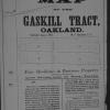
Butler & Bowman
1877
The lots shown on this subdivision map are bounded on the west by San Pablo Ave. and on the east by Gaskill St. Parsons St. is the southern boundary street and Menlo St. is the northern boundary... |
|
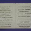
Oakland Enquirer Steam Book and Job Printing House
1877
This brochure advertises the sale of "the cheapest and best lots on the market" in Paradise Park whose northern portion is in Berkeley and whose southern portion is in Oakland. The lots are for... |
Pacific Press Print
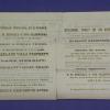
1877
In this brochure there are a number of pieces of property and dwellings offered at auction, in various Oakland neighborhoods. The first shown is an area between 13th and 14th Sts. from Magnolia... |