t.j. arnold
|
1877
The area subdivided on the map is bounded on the west by Peralta St. and on the east by Center St. West 12th St. is the southern boundary street and West 16th is the northern boundary street.... |
1875-1900
The area shown on this map is bound on the east by Kirkham St. and on the west by Center St. The southern boundary is 8th St. and the northern boundary is 11th St. The area is bisected by... |
|
1876
The area shown on this map is bound on the east by Kirkham St. and on the west by Center St. The southern boundary is 8th St. and the northern boundary is 11th St. The area is bisected by... |
1875
The lots shown on this subdivision map are confined to the area between Adeline St. and Union St. from 22nd St. to 24th St. Magnolia St. bisects the subdivision. Surveyed October 1875, T.J.... |
|
1876
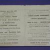
Map, real estate advertisement. The lots shown for sale are on West 8th-11th Sts., bounded by Center and Kirkham Sts. T.J. Arnold is shown to have surveyed the property in August 1875. J.O.... |
1877
The lots shown on this subdivision map front on Telegraph Ave., San Pablo Ave., 16th St. and 17th St. It is noted that the property was surveyed March, 1877, by T.J. Arnold, City-Engineer.Olney... |