Edward Denny & Co.
|
1916
White paper map of Nevada County set in a tan folder, with brown printing: "Denny's Pocket Map of Nevada County..." Stamped on the folder and on the map itself is: "White & Pollard, Bank of... |
1913
White paper map of Glenn County set in a tan folder, with blue printing: "Denny's Pocket Map of Glenn County California." Edward Denny & Co., Map Publishers, 674 Sacramento Street, San... |
|
1915
White paper map of Butte County set in a tan folder, with black printing: "Denny's PocketMap of Butte County California, showing townships, sections, roads, railroads, trails, etc. Compiled from... |
c.1913
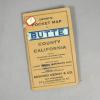
White paper map of Riverside County set in a brown leatherette folder, with an orange color label "Tulare County" " Denny's Pocket Map....A.C. McKenzie...Maps of all kinds.... |
|
1913
White paper map of Ventura County set in an orange colored folder, with black printing: "Denny's Pocket Map of Ventura County California showing wagon roads, railroads, trails, etc. Compiled from... |
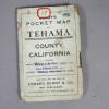
1913
White paper map of Tehama County set in a white folder, with black printing: "Denny"s Pocket Map of Tehama County California....published and for sale by Edward Denny & Co., Map Publishers,... |
|
1907
White paper map of Sonoma County set in a tan folder, with black printing: "Denny's Pocket Map of Sonoma County California, showing Townships, sections, roads, railroads, trails, ets. Compiled... |
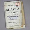
1904
White paper map of Shasta County set in a white folder, "Denny's Pocket Map of Shasta County and Eastern Portions of Trinity County compiled from official sources by Edward Denny & Co. Map... |
|
1913
White paper map of San Mateo County set in a blue leatherette folder. The map contains the following cities: South San Francisco, Burlingame, San Mateo, Belmont, Redwood City, Palo Alto,... |
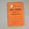
1916
White paper map of Santa Barbara County set in an orange colored folder, lettered in black: "Denny's Pocket MAp, Santa Barbara County, California...showing wagon roads, railroads, trails, etc.... |
|
1916
White paper map of San Luis Obispo County, printed in blue, set in a tan folder printed in brown: "Published for sale by Edward Denny & Co., Map Publishers, 674 Sacramento Street, San... |
c.1920
White paper Recreational Map of Monterey County and Vicinity, California, set in a brown leatherette folder, Denny's Pocket Map. Stamped on the label and on the map itself is: "White &... |
|
1912
White paper map of Merced County set in a brown leatherette folder. Map by Edward Denny & Co. Stamped on the front of the folder and on the map itself is: "White & Pollard, Bank of... |
c. 1914
White paper map of Mendocino County set in a tan folder, with black printing: "Denny's Pocket Map of Mendocino County, California. Showing Townships, Sections, Roads, Railroads, Trails, etc.... |
|
1912
White paper map of Kings County set in a brown leatherette folder, with black printing: "Denny's Pocket Map of Kings County showing wagon roads, railroads, trails, etc....." Stamped on the label... |
1913
White paper map of Imperial County set in a brown lined in marbelized paper, with black printing on a yellow label: "Denny's Pocket Map of Imperial County..." White paper tag is glued to front of... |
|
1913
White paper map of Humboldt County set in a tan folder, with black printing: "Denny's Pocket Map." White paper tag is glued to front of map, printed in blue: "Humboldt" and stamped on the label... |
1913
White paper map of Colusa County, printed in blue; set in a tan folder, with black printing: "Denny's Pocket Map of Colusa Country, California, showing townships, sections, roads, railroads,... |
|
1917
White paper map of Calaveras County set in a tan folder, with blue printing: "Denny's Pocket Map of Calaveras County, California. Showing townships, sections, roads, railroads, trains, etc.... |