maurice dore & co.
|
1875
The subdivision described here is bounded on the west by Antonio St. (20th Ave.) and on the east by Peralta St. (22d Ave.). The southern boundary street is Hepburn St. (east 21st St.) and the... |
1877
The area subdivided on the map is bounded on the west by Peralta St. and on the east by Center St. West 12th St. is the southern boundary street and West 16th is the northern boundary street.... |
|
1873
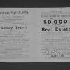
There are two parcels of property, each with its own map on this broadside advertisement. The first shown is that block of 5th St. between Adeline and Linden Sts. The second is the trapezoidal... |
1874
The lots shown in this subdivision map are contained by Franklin St. on the west and Harrison St. on the east; the southern boundary street is 12th and 14th St. is the northern boundary street.... |
|
1879
The lots shown on this subdivision map front on Grove St., Elm St. (or 24th St.), Laurel St. (or 25th St.) and Telegraph Ave. The real estate agents cited are Maurice Dore & Co. and Olney... |