map
|
1889
Map, real estate advertisement. The lots shown for sale are on Kennedy St. and Park St.; the area is bounded on the north by Frederick St. and on the south by Shasta Ave. "Only two blocks to the... |
1889
Map, real estate advertisement. The lots shown for sale are on Prospect Ave., Watson Ave., Peralta Ave., Oak St., Spruce St. Pine St., and Clinton Ave. "On the line of the New Electric Rail Road... |
|
April 12, 1890
Real estate advertisement, 30 villa sites on Cherry Ave., Rutherford Ave., Fruit Vale Ave., Saunders St., and Sherman St. (or Old County Road). The area has free mail delivery and water mains and... |
1890
Real estate advertisement. The lots shown in this advertisement are situated in four separate areas of Oakland; the first group of lots (54 in all) is situated on 16th and 17th Aves. bounded by... |
|
1883
Survey map shows an outline of a portion of Laundry Farm for Mrs. S. Tompkins by T.W. Morgan, C.E. The area shown is 67 106/1000 acres. Also shown are 35 14/100 acres surveyed for J.H:. Dorety,... |
1892
Map, real estate advertisement. The lots shown for sale are on 26th Avenue bounded by E. 14th and East 15th Sts. "Water piped - gas piped - sewer to each lot - streets macadamized - cement walks... |
|
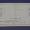
c. 1927
The map of the downtown Oakland area was produced by Sanborn Map Co. The area shown is the 1900 block of Telegraph and the lots bordered by 19th, 20th, and Broadway Streets. An ajacent lot... |
1950s
A triple fold map of Henry J. Kaiser's tract housing development in southern California, called Panorama City. It was picked up by the donor's grandmother, Elsie Shannon Holloway, who was looking... |
|
1919
A: Booklet "Rand-McNally Indexed Pocket Map and Auto Road Guide, California" (includes "Shippers' Guide, Railroads and Electric Lines, Counties, Congressional Townships, Cities, Towns, Villages... |
1914
White paper map of Tuolumne County set in a brown leatherette folder, with blue printing: "Map of Tuolumne County Cal. Copyright 1914 by Punnett Brothers, Drawn & Published by Punnett Brothers... |
|
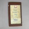
1913
White paper map of Yolo County set in a brown leathette folder. White paper label on the front reads: "Map of Yolo County Cal. Copyright 1913. By Punnett Brothers. A. C. McKenzie, 117 Russ... |
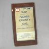
1908
White paper map of Sierra County set in a brown leatherette folder, "Map of Sierra County Cal. Copyright, 1908 by Punnett Brothers, for sale by A. C. McKenzie, 117 Russ Building, Montgomery, Bush... |
|
1913
White paper map of Madera County set in a brown leatherette folder, witha white label and blue printing: "Map of Madera County, Cal., copyright 1913 by Punnett Brothers, Drawn and Published by... |
1909
White paper map of Del Norte County set in a brown leatherette folder, with blue printing, county borders and name printed in green. White label on the front indicates: "For sale by A. C.... |
|
1908
White paper map of Kern County set in a brown leatherette folder: "Map of Kern County, Cal., Copyright, 1908, by Punnett Brothers." Also printed is "For Sale by A. C. McKenzie, 117 Russ Building,... |
1914
White paper map of Fresno County set in a brown leathette folder with blue and pink printing. "Fresno County" is hand printed on a white label with red borders. "For sale by A. C. McKenzie, Room... |
|
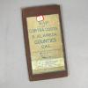
1908
White paper map of Contra Costa and Alameda Counties set in a brown leatherette folder, with blue printing; Contra Costa County outlined and named printed in green; Alameda County outlined and... |
1908
White paper map of El Dorado and Amador Counties set in a brown leatheretten folder, with blue printing: "Map of El Dorado & Amador Counties, Cal. Copyright 1908, by Punnett Brothers." Another... |
|
1907
This is a map showing the areas of San Francisco affected by the 1906 earthquake and fire. The map also states that the building permits issued after the fire totaled $60,189,923. |
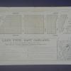
June 22, 1889
Real estate advertisement, map of Highland Park on one side; text on the other side: 25' lots, in East Oakland two blocks from the Highland Park Street Car Line. |
|
1885
Map, real estate advertisement. The lots shown for sale are on San Pablo Ave., Grove St., and 28th-31st Sts. 54 building lots are included in this offering. William J. Dingee is listed as the... |
1886
Real estate advertisement. Three separate properties are listed for sale here; the first is a residence located on Glen Ave. [now Wallace St.] and East 24th St.; the second is a cottage located... |
|
1875-1900
There are no street names or landmarks shown on this map; its main purpose, it appears, is to show railroad lines (both steam and electric) throughout the community. It is estimated that the date... |
1875-1900
The area shown on this subdivision map is from 26th St. to 28th St.; the north-south intersecting streets are San Pablo Ave., West St., and Grove St. "Located between San Pablo and Telegraph... |