map
|
1913
White paper map of Colusa County, printed in blue; set in a tan folder, with black printing: "Denny's Pocket Map of Colusa Country, California, showing townships, sections, roads, railroads,... |
1913
White paper map of Humboldt County set in a tan folder, with black printing: "Denny's Pocket Map." White paper tag is glued to front of map, printed in blue: "Humboldt" and stamped on the label... |
|
1917
White paper map of Calaveras County set in a tan folder, with blue printing: "Denny's Pocket Map of Calaveras County, California. Showing townships, sections, roads, railroads, trains, etc.... |
1868
The area shown on the subdivision map is bounded on the west by San Pablo Road and on the east by Grove St. The boundary street on the north is Campbell Ave. (perhaps 27th St.) and on the south... |
|
1875-1900
Map, real estate advertisement. The lots shown for sale are on West St., Park St. (now 27th St.) and Grove St. E.J. Kelley & Co. is the real estate agency listed. The price range shown is $... |
c. 1912
White paper map of Mono County set in a taupe folder, with black printing: "Progressive Map Service, Dan W. Chamberlin, Engineers, Designers, Map Publishers, Fresno, California..." Stamped on the... |
|
c. 1913
White paper map of Marin County set in a gray folder, with black printing: "Map of Marin County, California... issued by Progressive Map Service, Da. W. Chamberlin, Engineers, Designers, Map... |
1914
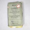
White paper map of Lassen County set in a gray folder, with black printing: "Map of Lassen County, California ... issued by Progressive Map Service, Dan W. Chamberlin, Engineers, Designers, Map... |
|
1925
White paper map of Lake County set in a tan folder, with black printing: "Progressive Map of Lake County, California...issued by Progressive Map Service, Chamberlin & Vingenz, Engineers,... |
c.1920
White paper map of Plumas County set in a tan folder, with black printing: "Weber's Map of Plumas County California....Published by C. F. Weber & Co., 365 Market Street, San Francisco; 512... |
|
1914
White paper map of Los Angeles County and Orange County set in a tan folder, with brown printing: "Weber's Map of Los Angeles & Orange County, California..." Stamped on the folder and on the... |
1912
White paper map of Modoc County set in a tan folder, with blrown printing: "C. F. Weber & Co...." Modoc County is outlined with a border of red, and the adjacent counties are named in red:... |
|
1913
White paper map of Napa and Solano Counties set in a brown leatheretten folder, with a label for "For Sale by A. C. McKenzie, 117 Russ Building, Montgomery, Bush and Pine Streets, San Francisco,... |
1876
Map, real estate advertisement. The lots shown for sale are on West 8th-11th Sts., bounded by Center and Kirkham Sts. T.J. Arnold is shown to have surveyed the property in August 1875. J.O.... |
|
1875-1900
Map, real estate advertisement. The lots shown for sale are on San Pablo Ave. and 15th St. One addition site is advertised at the N.W. corner of Broadway and First St. E.C. Sessions is listed... |
1874
The lots shown on this map front on Pleasant Valley Avenue (Boulevard or Grand Ave. as these streets were later known as), Lake View Ave. and Vermont St. An area also shown to be subdivided into... |
|
1875-1900
The map shows the Alameda Valley Homestead Association Tract northeast of Fruit Vale Ave. and bounded on the east by what wouuld be an extension of High St. The northern boundary of the tract... |
1875-1900|ca. 1868
The lots shown on this subdivision map are bounded on the south partially by 41st, 42d, 43d, and 44th Sts.; the northern boundary of the subdivision is Temescal Creek. Telegraph Ave. is the... |
|
1868
The area shown in this subdivision map is bounded by Telegraph Ave. on the west and Broadway on the East. Vassar St. is the northern boundary St. and College Ave. (not the current College Ave. in... |
1871
The lots shown on this subdivision map are mostly situated between Telegraph Ave. and Adeline St. The northern boundary St. is Menlo St. and the southern boundary street is Alpine St. The other... |
|
1868
The area shown in this subdivision map is bounded by Linden's lane on the south and Vernon Ave. on the north. The western boundary street is Telegraph Ave; the eastern boundary street is not... |
1868
The lots shown on this map front on Peralta St., Chester St. West Tenth St., West Twelfth St., West Fourteenth St. West Sixteenth St., and Center St. Peralta St. and Center St. converge to form... |
|
1914
White paper map of Santa Clara County set in a brown leatherette folder, "A. C. McKenzie..." Stamped on the folder and on the map itself is: "White & Pollard, Bank of Commerce Building,... |
1913
White paper map of Riverside County set in a brown leatherette folder, "A. C. McKenzie, 11& Russ Building, Montgomery, Bush & Pine Streets, San Francisco, Cal., Maps of all kinds."... |


