map
|
1893
Real estate advertisement. The lots shown on the map are on Bay Ave., Marion Ave., and Olive Ave. Fourteenth St. provides the southern border of the offered lots. "The Hemphill Tract is located... |
1857
This is a topographical map which also shows water depths along the coasts of Oakland, Alameda, and San Antonio Creek. The towns of Oakland and Brooklyn are shown; there appears to be no... |
|
ca. 1875-1900
Real estate advertisement, map of Santa Fe Tract on one side; text on the other side: off Baker Avenue one block from Seminary. "The climate is mild and healthful, and our prettiest girls are... |
1889
Map, real estate advertisement. The lots shown for sale by auction are on Lane, St., Tevis St., and Putnam St. The area is bounded by the Oakland and San Leandro Road, and the Central Pacific... |
|
1869
The lots in this subdivision front on the following streets: Lake Shore Ave.), Brooklyn, Ave., Peralta Ave. (now Cleveland Ave.), Bay Ave. (probably Wesley Ave.), Howard St. (probably Haddon Rd... |
1870
This subdivision is bounded on the west by Peralta and Willow Sts., and on the east by Henry St. The southern boundary street is Fulton St., and the northern boundary street is First St. The "... |
|
Late 20th Century
This is a laminated color copy, of a map created in 1949, by the French of Indochina- Vietanam, Cambodia, CochinChina, Siam. |
1875-1900
The area shown on this map lies between Evoy Ave. (38th St.) and Geary St. (or 39th St.). Telegraph Road is shown to be the western boundary of the area; the eastern boundary street is not named... |
|
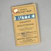
1913
White paper map of Glenn County set in a tan folder, with blue printing: "Denny's Pocket Map of Glenn County California." Edward Denny & Co., Map Publishers, 674 Sacramento Street, San... |
1916
White paper map of Nevada County set in a tan folder, with brown printing: "Denny's Pocket Map of Nevada County..." Stamped on the folder and on the map itself is: "White & Pollard, Bank of... |
|
1915
White paper map of Butte County set in a tan folder, with black printing: "Denny's PocketMap of Butte County California, showing townships, sections, roads, railroads, trails, etc. Compiled from... |
c.1913
White paper map of Riverside County set in a brown leatherette folder, with an orange color label "Tulare County" " Denny's Pocket Map....A.C. McKenzie...Maps of all kinds.... |
|
1907
White paper map of Sonoma County set in a tan folder, with black printing: "Denny's Pocket Map of Sonoma County California, showing Townships, sections, roads, railroads, trails, ets. Compiled... |
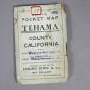
1913
White paper map of Tehama County set in a white folder, with black printing: "Denny"s Pocket Map of Tehama County California....published and for sale by Edward Denny & Co., Map Publishers,... |
|
1913
White paper map of Ventura County set in an orange colored folder, with black printing: "Denny's Pocket Map of Ventura County California showing wagon roads, railroads, trails, etc. Compiled from... |
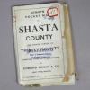
1904
White paper map of Shasta County set in a white folder, "Denny's Pocket Map of Shasta County and Eastern Portions of Trinity County compiled from official sources by Edward Denny & Co. Map... |
|
1913
White paper map of San Mateo County set in a blue leatherette folder. The map contains the following cities: South San Francisco, Burlingame, San Mateo, Belmont, Redwood City, Palo Alto,... |
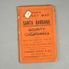
1916
White paper map of Santa Barbara County set in an orange colored folder, lettered in black: "Denny's Pocket MAp, Santa Barbara County, California...showing wagon roads, railroads, trails, etc.... |
|
c. 1914
White paper map of Mendocino County set in a tan folder, with black printing: "Denny's Pocket Map of Mendocino County, California. Showing Townships, Sections, Roads, Railroads, Trails, etc.... |
1912
White paper map of Merced County set in a brown leatherette folder. Map by Edward Denny & Co. Stamped on the front of the folder and on the map itself is: "White & Pollard, Bank of... |
|
c.1920
White paper Recreational Map of Monterey County and Vicinity, California, set in a brown leatherette folder, Denny's Pocket Map. Stamped on the label and on the map itself is: "White &... |
1916
White paper map of San Luis Obispo County, printed in blue, set in a tan folder printed in brown: "Published for sale by Edward Denny & Co., Map Publishers, 674 Sacramento Street, San... |
|
1912
White paper map of Kings County set in a brown leatherette folder, with black printing: "Denny's Pocket Map of Kings County showing wagon roads, railroads, trails, etc....." Stamped on the label... |
1913
White paper map of Imperial County set in a brown lined in marbelized paper, with black printing on a yellow label: "Denny's Pocket Map of Imperial County..." White paper tag is glued to front of... |