map
|
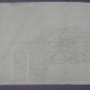
1875-1900
In this original map, an area on both sides of University Ave. (now College Ave.) are shown. The area east of University Ave. is bounded on the south by Fourth Ave. (now Manila Ave.), on the... |
1880
In this original map, the area presented is mostly, what at that time was marsh land at Oakland Point, and what has later become the beginning of the major land fill that characterizes the... |
|
1875-1900
The area shown in this original map is bounded on the west by Webster St., on the north by 13th St., on the east by the Oakland Estuary, and on the south by the Inner Harbor and Estuary Park. The... |
1875-1900
The area shown on the subdivision map is bounded on the west by Shattuck St. and on the east by Telegraph Ave. (in part) and Racine St. (in part). The southern boundary street is Mono Ave. (not... |
|
1890
The lots shown on this subdivision map are bounded on the west by San Pablo Ave. and Lowell St. on the east. Menlo Ave. is the southern boundary street and what is today probably 59th St. is the... |
1875-1900
The lots shown on this subdivision map are confined to the area between San Pablo Ave. and Grove St. between Rowland St. (probably 31st St. today) and Wallace Ave. (probably 28th St. today) The... |
|
1875-1900
The area shown on this subdivision map is from 13th St. to 15th St., with Adeline, Magnolia, and Union Sts. being the intersecting streets. Only 4 square city blocks are shown. |
1869
The area shown on this survey map for Henry Durant appears to be in the Prescott and/or the South Prescott neighborhoods. It is an area of 44 43/100 acres with First St. and Peralta St. as the... |
|
1875-1900
The lots shown on this hand-made drawing are on 45th, 44th, 43d, and 42nd Sts. Telegraph Ave. is the easterly boundary St. and West St. is the most westerly street shown. Geary St. appears to be... |
1885
The lots shown on this hand-made drawing are on Lusk St., Grove St. and Telegraph Ave., from 40th St. to 45th St. Alden Tract is not listed in the "Tract List" compiled by Quentin. Henry C.... |
|
1875-1900
Original drawing of a section of Oakland that shows what appears to be the convergance of Broadway and Webster St. at an acute angle. Moss Ave. forms the third side of that triangle. Lot... |
1875-1900
Survey map shows sections of land apparently identified by owner; the land areas are not subdivided into streets or avenues. The area shown appears to be the Woodland and Highland neighborhoods... |
|
1875-1900
Survey map shows San Antonio Creek and its tributaries; the streets in the area are not named or numbered. The map appears to be hand-drawn and some areas of the map are tinted. |
1875-1900
Survey map shows what appears to be San Antonio Park and its environs. |
|
1875-1900
Survey map shows lots on Fruit Vale Ave., Champion St., Boston Ave., Chicago Ave., and School St. Fruit Vale School is shown on the map as being at the intersection of Boston Ave. and School St... |
1875-1900
Map, real estate advertisement. The lots shown for sale are on 36th, 37th, 38th, Apgar, and 39th Sts., bounded by West and Grove Sts. M.J. Laymance is the listed real estate agency. "...the... |
|
1875-1900
Survey map shows a number of lots on both sides of High St. at or about what is today the intersection of Foothill Blvd. and High St. Also shown, south of this area, is an area of undeveloped... |
1889
Map, real estate advertisement. The lots shown for sale are on 5th-7th Sts., bounded by Oak St. on the West and Fallon St. on the East. Also included in the auction is an "...elegant residence... |
|
1875-1900
Map, real estate advertisement. The lots shown for sale are on San Pablo Avenue, Park St., Menlo St. Sutter St. and Parsons St. Title and subject elements for this item are suggested by a... |
1875-1900
Map, real estate advertisement. The lots shown for sale are on Telegraph Road, Franklin St. Bay Place, and Laurel St; 40 lots are available. |
|
1892
Map, real estate advertisement. The lots shown for sale are on Grant Ave. and San Leandro Rd. [East 14th St.] |
1890
Map, real estate advertisement. The lots shown for sale are on 23rd Avenue between 26th and 27th Sts. "These 39 beautiful lots! 30 to 50 feet front, and from 120 to 160 feet deep, are sold by... |
|
1891
Map, real estate advertisement. The lots shown for sale are on Dimond Ave., Fruit Vale Avenue, and Hopkins St. The Tract is bounded on the south by Hopkins St. and on the north by a ditch;... |
1892
Map, real estate advertisement. The lots shown for sale are on Prospect Ave., and East 14th-18th Sts. The area is bounded by E. 14th St. and Prescott St. "Situated on East 14th Street, or San... |