real estate advertisement
|
1886
The area of this subdivision is bounded on the west by Fruit Vale Ave. and on the east by what is probably 34th Ave. The southern boundary street is East 14th St. (or San Leandro Road), and the... |
1877
The lots shown in the subdivision on the map face Thirty-eighth St. and Telegraph Ave. Also shown are the residences of J.B. Bon, Peter Thomson, and J. Mora Moss. Grove St. is shown to be... |
|
1878
The area shown on the map runs from Broadway on the west to Lake Peralta on the east; the southern boundary street is Walnut (or 22nd) and the northern boundary street is Elm (or 24th). The lots... |
1886
The area shown on the map on p. 2 of this brochure is bounded by Webster Ave. (now Piedmont Ave.) on the west and what is probably today Oakland Ave. to the east. The streets shown are Glen Ave... |
|
1877
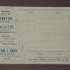
In this brochure there are a number of pieces of property and dwellings offered at auction, in various Oakland neighborhoods. The first shown is an area between 13th and 14th Sts. from Magnolia... |
1875-1900
The area shown on this map is from 36th (or Logan St.) to 39th St.; West St. is is the north-south intersecting street. The lots front on 36-39th Sts. and West St. which intersects those streets... |
|
1885
The area shown on this map is from Eleventh St. to Twelfth St., from Market St. to West St. William J. Dingee and Easton & Eldridge are cited as the real estate agents. "22 choice, centrally... |
1875-1900
The area shown on this drawing is on the easterly side of Telegraph Ave. (or Humboldt Ave.) and Canning St. from Maple St. to Alcatraz Ave. (currently from 58th St. to Alcatraz Ave.) From north... |
|
1886
The lots to be sold at auction are on Market, 39th, 40th, 41st and 42d Sts. between Telegraph and San Pablo Avenues. Most of the subdivisioni has Market St. as its axis. "These lots being just... |
1875-1900
The area shown on the map on the verso of this advertisement lies from Alcatraz Ave. to the north to Stanley St. to the south. The streets in between are Felton, Todd, McKee, Benton, and Mariposa... |
|
1887
The area shown on the map on the verso of this advertisement lies, from what is today, between Piedmont Ave. and Oakland Ave. from about MacArthur Blvd. on the south to Pleasant Valley Ave or... |
1891
The area shown on the map on the verso of this leaflet lies between Chetwood St, and Oakland Ave. on Moss Ave., Santa Clara Ave, Santa Rose Ave, and Vernon St. "The only tract between Oakland and... |
|
1885
Map, real estate advertisement. The lots shown for sale are on San Pablo Ave., Grove St., and 28th-31st Sts. 54 building lots are included in this offering. William J. Dingee is listed as the... |
1886
Real estate advertisement. Three separate properties are listed for sale here; the first is a residence located on Glen Ave. [now Wallace St.] and East 24th St.; the second is a cottage located... |
|
1878
In this 8-page leaflet, a number of separate properties are offered at auction. On p. 2, an area situated on San Pablo Ave., Grove and Curve Sts., consisting of 20 lots is offered. On p. 3, lots... |
1903
This real estate advertisement appeared as a full page ad in the Oakland Tribune, Tuesday evening, December 22, 1908; the Realty Syndicate is offering the subdivision lots for sale. The streets... |
|
1895
The business lots shown on this subdivision map all front on Grove St. between Hobart St. (22d St.) and Elm St. (24th St.) The residences mentioned are on Sycamore (between West and Grove Sts.),... |
1890
The area of this subdivision is bounded on the west by 23d Ave. and on the east by Orange Ave. (now, probably Grande Vista Ave.) The southern boundary street is 24th St. and the northern boundary... |
|
1887
The area shown on this subdivision map is from San Pablo Avenue on the west, to Lowell St. on the east. The southern boundary is Crawford St. and the northern boundary is Harmon St. Alcatraz Ave... |
1875-1900
The Huntington Tract is bounded on the west by High St. and on the east by Bay Ave. East 14th St. is the northern boundary street and east 9th St. is the southern boundary street. East 10th and... |
|
1875-1900
The Huntington Tract is bounded on the west by Church St. and on the east by Davenport St. Herbert St., Todd St., and Beck St. are the three east-west streets that intersect with Church and... |
1889
The lots shown on this subdivision map are confined to the area bounded by San Pablo Ave. on the west and Adeline St. on the east. The northern boundary street is Parsons Ave. and Lulu Ave. is... |
|
1890
The subdivision shown on the large street map runs from 24th St. to 27th St.; the eastern boundary street is Orange Ave. (25th Ave.) and the western boundary street is 23rd Ave. Sunnyside Ave. (... |
1889
The lots shown on this map front on San Pablo Ave. and the intersecting streets of Parsons Ave., Central Ave., Mattie Ave., and Lulu Ave. Other lots included in this subdivision front on Park St... |